
These Indian geography notes pull together the most-tested parts of India’s physical geography into one revision-friendly guide. Covering the physical divisions, river systems, climate, soils and minerals, these Indian geography notes are built for SSC, Railway and State PSC aspirants who want the high-yield facts organised clearly. Geography rewards a mental map, so read these notes alongside a physical map of India for the best results.
Table of Contents
Why geography matters in exams
Geography is a large and stable component of the general awareness section, and it connects to several other areas: current affairs (disasters, projects), economy (agriculture, minerals) and even history (trade routes, settlements). Because the physical features of India do not change, the facts you learn once stay useful across every attempt. Building a clear picture of where things are — mountains, rivers, plateaus, coasts — lets you answer both direct factual questions and the map-based items that appear more often each year.
Physical divisions of India
India is divided into six major physical regions, each with distinct features:
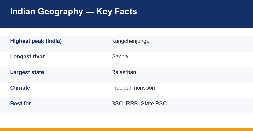
- The Himalayan Mountains — young fold mountains in the north, home to the highest peaks; Kangchenjunga is the highest peak within India.
- The Northern Plains — formed by the alluvium of the Indus, Ganga and Brahmaputra; the most fertile and densely populated region.
- The Peninsular Plateau — the oldest landmass, rich in minerals, bordered by the Western and Eastern Ghats.
- The Indian (Thar) Desert — the arid region in the northwest, mainly in Rajasthan.
- The Coastal Plains — the western and eastern coastal strips along the Arabian Sea and the Bay of Bengal.
- The Islands — the Andaman & Nicobar Islands in the Bay of Bengal and the Lakshadweep Islands in the Arabian Sea.
A common exam point is that the Peninsular Plateau is the oldest part of India, while the Himalayas and the Northern Plains are geologically young. Another is that the Western Ghats are continuous and higher than the broken Eastern Ghats.
River systems
India’s rivers fall into two systems. The Himalayan rivers — the Ganga, Yamuna, Brahmaputra and Indus — are perennial, fed by snow and rain, and form vast plains and deltas. The Peninsular rivers — the Godavari, Krishna, Kaveri, Narmada and Tapi — are largely rain-fed. Most peninsular rivers flow east into the Bay of Bengal, but the Narmada and Tapi are notable exceptions that flow west into the Arabian Sea. For a fuller treatment, see our dedicated notes on the major rivers of India and the important dams in India built on them.
Climate & the monsoon
India has a tropical monsoon climate, defined by the seasonal reversal of winds. The year is broadly divided into four seasons: winter (December to February), summer (March to May), the southwest monsoon or rainy season (June to September) and the retreating monsoon (October to November). The southwest monsoon, which arrives first on the Kerala coast around early June, brings the bulk of India’s annual rainfall and is critical for agriculture. Mawsynram and Cherrapunji in Meghalaya are among the wettest places on earth, while parts of Rajasthan are arid. The monsoon’s timing and strength are recurring current-affairs topics too.
Soils of India
Soil questions are common and map onto agriculture. The major soil types are alluvial soil (the most widespread and fertile, across the Northern Plains, ideal for wheat and rice), black soil or regur (found on the Deccan lava region, excellent for cotton), red soil (over much of the Peninsular Plateau), laterite soil (in high-rainfall areas, good for plantation crops), and desert and mountain soils in their respective regions. Linking each soil to its region and its main crop answers most soil questions in one step.
Minerals & resources
The Peninsular Plateau makes India rich in minerals, and the mineral belt of the northeast Deccan — especially Jharkhand, Odisha and Chhattisgarh — is heavily tested. India has significant reserves of coal (mainly in the Damodar valley), iron ore, bauxite, manganese and mica. Questions often ask which state leads in a particular mineral, or which mineral a region is known for, so pair each major mineral with its leading states. Mineral and energy resources also connect to economy and current-affairs questions on industry and power.
Agriculture & cropping seasons
Agriculture links geography with the economy and is frequently tested. India has three main cropping seasons: Kharif (sown with the monsoon in June-July, harvested in autumn; crops include rice, maize, cotton and bajra), Rabi (sown in winter, harvested in spring; crops include wheat, gram and mustard) and Zaid (a short summer season; crops include watermelon and cucumber). Pairing a crop with its season and its soil — rice with kharif and alluvial soil, cotton with black soil — answers a whole cluster of questions in one step.
Quick geography facts
A few standout facts recur across exams: the Tropic of Cancer passes through eight Indian states; the southern tip of mainland India is Kanyakumari, while the southernmost point of Indian territory is Indira Point in the Andaman & Nicobar Islands; the Western Ghats are a UNESCO biodiversity hotspot; and India shares its longest land border with Bangladesh. Facts like these are the kind of direct, map-linked questions that reward a clear mental map of the country.
How to revise Indian geography notes
Geography is best revised with a map in front of you. Fix the six physical divisions first, then layer rivers, climate zones, soils and minerals onto that mental map. Learn facts in linked groups — region, soil and crop together; river and the states it flows through together — rather than as isolated points. Revised this way, these Indian geography notes turn a large syllabus into a connected picture that is far easier to recall under exam pressure. You can verify specific facts on the National Portal of India.
Frequently Asked Questions
What are the major physical divisions of India?
India has six physical divisions: the Himalayan Mountains, the Northern Plains, the Peninsular Plateau, the Indian Desert, the Coastal Plains and the Islands.
Which type of climate does India have?
India has a tropical monsoon climate, dominated by the seasonal reversal of winds that brings the southwest monsoon rains from June to September.
Which is the most widespread soil in India?
Alluvial soil is the most widespread and fertile soil in India, found mainly across the Northern Plains.
Why is geography important for competitive exams?
Geography features heavily in the general awareness sections of SSC, Railway and State exams, and it also supports map-based and current-affairs questions.